Creación de zonas de gestión
Para crear zonas de gestión normalmente trabajaremos con los resultado del map mixer.

Para crear zonas de gestión normalmente trabajaremos con los resultado del map mixer.
El plan de abonado define las cantidades óptimas de nutrientes básicos que deben suministrarse al cultivo para proporcionarle las condiciones adecuadas para su crecimiento permitiendo disminuir el impacto ambiental de la aplicación en los suelos agrarios de productos fertilizantes. Un plan de abonado correctamente elaborado requiere tener en cuenta las necesidades de nutrientes para un determinado cultivo junto con la estimación de la cantidad de nutrientes actualmente disponibles en el suelo. Los planes de abonado deben especificar las dosis para cada uno de los nutrientes (N, P, K y Mg) junto con las necesidades de encalado y pueden elaborarse por escrito…
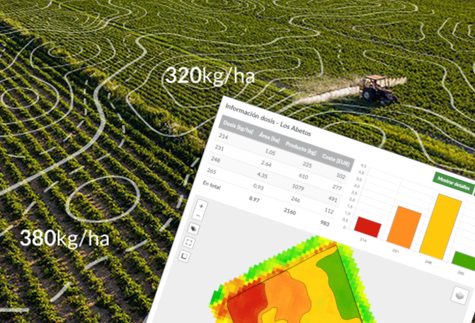
Un mapa de prescripción bien elaborado te permite optimizar el uso de fertilizantes y otros fitosanitarios, al tiempo que garantiza que tus cultivos reciben los nutrientes que necesitan. Las imágenes de satélite ofrecidas en SatAgro constituyen una base especialmente útil para este tipo de mapas, sobre todo en el caso de la fertilización nitrogenada. Para crear un mapa de prescripción basado en imágenes de satélite, simplemente tienes que seguir estos 6 pasos: 1. Selecciona un mapa de vegetación La forma más fácil para seleccionar una determinada imagen para crear un nuevo tratamiento es a través del mapa disponible en el…
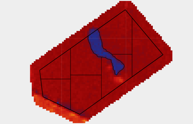
What are the benefits of using SatAgro to plan soil sampling? The state of your crop is at the same time a result and an indicator of the underlying soil’s chemistry. With SatAgro’s help you can easily plan soil sampling based on biomass variability. The results will be more accurate and can be transformed into a prescription map within SatAgro. For example, in a particularly wet year parts of the field experience inundation that stops the crop from developing. These wet zones are visible on satellite imagery. The field can thus be divided into two areas, where: The current crop…
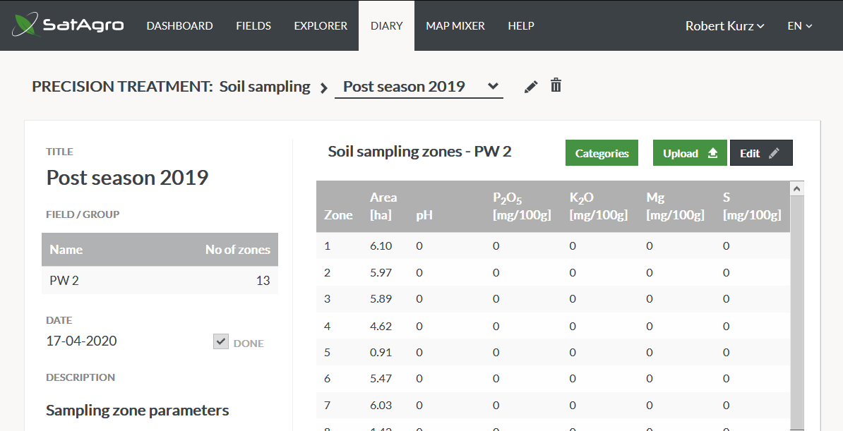
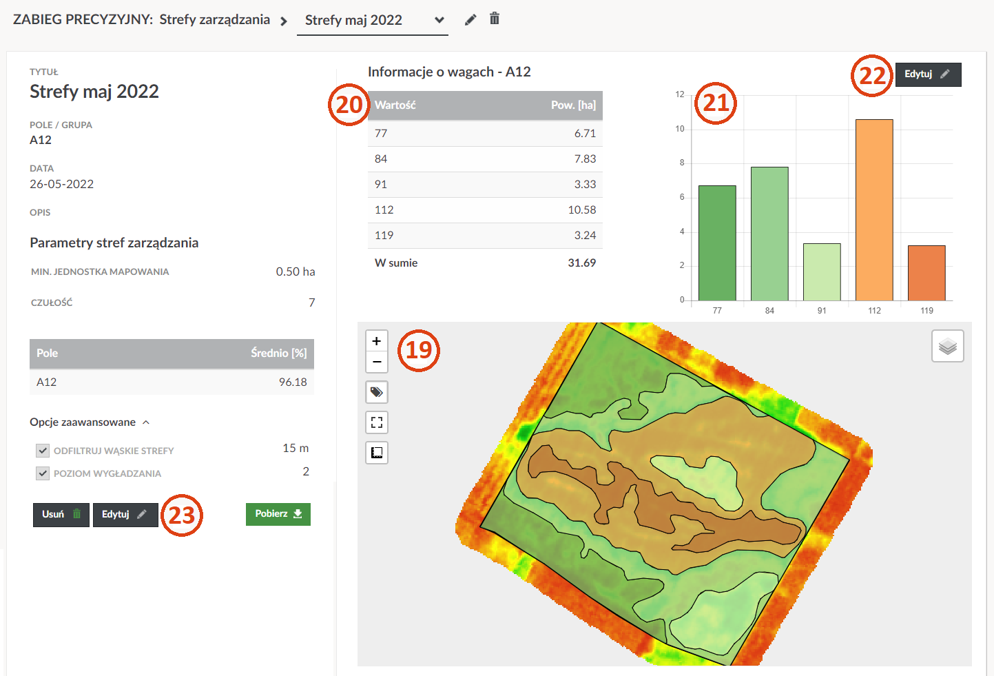
Once you have received the test results, find the field zoning generated earlier in the “Diary” section. In the table above the zoning preview, there are now only zeroes. To fill out the table with results, click on the “Edit” button. You can now enter the values for the properties tested in each individual zone. If you have received the results in the form of electronic files (preferably spatial, e.g. .shp) you can send us the results by clicking «Import». Remember that we must be able to unambiguously assign the results to specific parts of the field – it is…

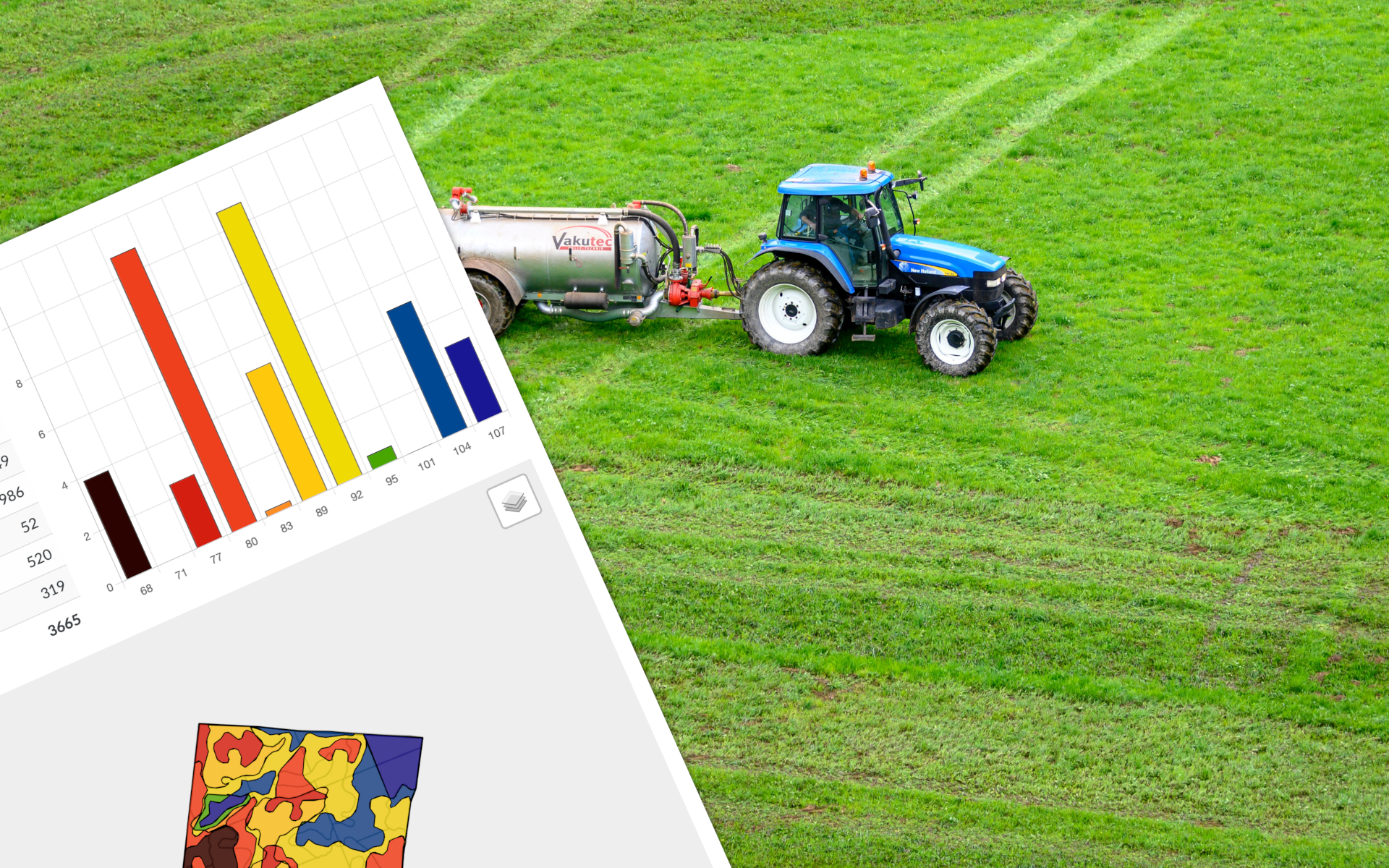
To create a variable variable rate map based on the results of a soil survey, just follow these few steps – if you have already made a fertilisation map based on a satellite image, most of the process will be familiar to you. 1. Display the sampling results in the «Explorer» Select «Soil sampling» from the «Show on map» list. The map will show the division of the field into zones, and on the left side of the map you will see a selection of characteristics/components. Select the soil property based on which you want to plan a precision treatment,…
When you decide to download precision treatment files for use in the field or in different software, the system will ask you to choose a file format: shp – also called a Shapefile, ESRI shapefile, .shp. You can edit this file yourself in GIS software – for experienced users. ISOXML – file format used in ISOBUS compatible machinery. anl – file format compatible with AGROCOM MAP software csv – basic file format for tabular data, accessible in e.g. Excel kml – this can be used in Google Earth terminal’s format – CHOOSE THIS OPTION if you plan to use the…
